


Pennyrile Area Development District (North) PUMA, Kentucky
About
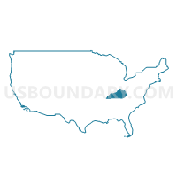
Outline
+PUMA%2c+Kentucky_A280.png)
Summary
| Unique Area Identifier | 192989 |
| Name | Pennyrile Area Development District (North) PUMA |
| State | Kentucky |
| Area (square miles) | 2,095.44 |
| Land Area (square miles) | 2,026.94 |
| Water Area (square miles) | 68.50 |
| % of Land Area | 96.73 |
| % of Water Area | 3.27 |
| Latitude of the Internal Point | 37.25296520 |
| Longtitude of the Internal Point | -87.73872030 |
Maps
+PUMA in Kentucky.png)
Graphs
Select a template below for downloading or customizing gragh for Pennyrile Area Development District (North) PUMA, Kentucky
+PUMA%2c+Kentucky_T0.png)
+PUMA%2c+Kentucky_T1.png)
+PUMA%2c+Kentucky_T2.png)
+PUMA%2c+Kentucky_T3.png)
+PUMA%2c+Kentucky_T4.png)
+PUMA%2c+Kentucky_T5.png)
+PUMA%2c+Kentucky_T6.png)
+PUMA%2c+Kentucky_T7.png)
+PUMA%2c+Kentucky.png)
Neighbors
Neighoring Public Use Microdata Area (by Name) Neighboring Public Use Microdata Area on the Map
- Barren River Area Development District (Outer) PUMA, KY
- Green River Area Development District (Southwest) PUMA, KY
- Pennyrile Area Development District (South) PUMA, KY
- Purchase Area Development District PUMA, KY
- South & Southeast Illinois PUMA, IL
Top 10 Neighboring County (by Population) Neighboring County on the Map
- Christian County, KY (73,955)
- McCracken County, KY (65,565)
- Hopkins County, KY (46,920)
- Muhlenberg County, KY (31,499)
- Marshall County, KY (31,448)
- Logan County, KY (26,835)
- Ohio County, KY (23,842)
- Massac County, IL (15,429)
- Union County, KY (15,007)
- Trigg County, KY (14,339)
Top 10 Neighboring County Subdivision (by Population) Neighboring County Subdivision on the Map
- Paducah CCD, McCracken County, KY (51,458)
- Madisonville CCD, Hopkins County, KY (29,004)
- Calvert City CCD, Marshall County, KY (14,249)
- Greenville CCD, Muhlenberg County, KY (11,892)
- Princeton CCD, Caldwell County, KY (10,909)
- Central City CCD, Muhlenberg County, KY (8,696)
- Smithland CCD, Livingston County, KY (6,545)
- Eddyville CCD, Lyon County, KY (6,444)
- Dawson Springs CCD, Hopkins County, KY (6,292)
- Crofton CCD, Christian County, KY (6,203)
Top 10 Neighboring Place (by Population) Neighboring Place on the Map
- Madisonville city, KY (19,591)
- Princeton city, KY (6,329)
- Central City city, KY (5,978)
- Greenville city, KY (4,312)
- Marion city, KY (3,039)
- Dawson Springs city, KY (2,764)
- Ledbetter CDP, KY (1,683)
- Earlington city, KY (1,413)
- Nortonville city, KY (1,204)
- Rosiclare city, IL (1,160)
Top 10 Neighboring Unified School District (by Population) Neighboring Unified School District on the Map
- Christian County School District, KY (60,270)
- McCracken County School District, KY (45,095)
- Hopkins County School District, KY (44,301)
- Muhlenberg County School District, KY (31,499)
- Marshall County School District, KY (31,448)
- Ohio County School District, KY (23,842)
- Logan County School District, KY (20,760)
- Union County School District, KY (15,007)
- Trigg County School District, KY (14,336)
- Massac Unit School District 1, IL (13,893)
Top 10 Neighboring State Legislative District Lower Chamber (by Population) Neighboring State Legislative District Lower Chamber on the Map
- State House District 118, IL (99,068)
- State House District 14, KY (45,708)
- State House District 17, KY (42,990)
- State House District 6, KY (41,978)
- State House District 8, KY (41,126)
- State House District 7, KY (39,972)
- State House District 4, KY (39,505)
- State House District 16, KY (39,295)
- State House District 15, KY (38,558)
- State House District 10, KY (38,450)
Top 10 Neighboring State Legislative District Upper Chamber (by Population) Neighboring State Legislative District Upper Chamber on the Map
- State Senate District 59, IL (209,843)
- State Senate District 32, KY (126,482)
- State Senate District 1, KY (113,784)
- State Senate District 3, KY (113,250)
- State Senate District 4, KY (106,696)
- State Senate District 8, KY (106,187)
- State Senate District 2, KY (105,262)
- State Senate District 6, KY (102,261)
Top 10 Neighboring 111th Congressional District (by Population) Neighboring 111th Congressional District on the Map
Top 10 Neighboring Census Tract (by Population) Neighboring Census Tract on the Map
- Census Tract 9602, Muhlenberg County, KY (7,434)
- Census Tract 9703, Hopkins County, KY (7,036)
- Census Tract 402, Livingston County, KY (6,545)
- Census Tract 9601, Lyon County, KY (6,444)
- Census Tract 311, McCracken County, KY (5,835)
- Census Tract 9203, Caldwell County, KY (5,672)
- Census Tract 9501, Marshall County, KY (5,342)
- Census Tract 9604, Muhlenberg County, KY (5,335)
- Census Tract 9202, Caldwell County, KY (5,237)
- Census Tract 9705, Hopkins County, KY (5,146)
Top 10 Neighboring 5-Digit ZIP Code Tabulation Area (by Population) Neighboring 5-Digit ZIP Code Tabulation Area on the Map
- 42003, KY (29,683)
- 42431, KY (26,916)
- 42211, KY (13,422)
- 42345, KY (11,747)
- 42445, KY (11,331)
- 42330, KY (9,386)
- 42064, KY (8,421)
- 42320, KY (8,205)
- 42220, KY (6,844)
- 42408, KY (6,737)